


For high definition imaging and recording of full borehole wall, snapshot of key positions, and measurement of borehole trajectory;
Measuring space trajectory and actual depth of boreholes;
Observing occurrence and development of fault crevice;
Observing water outlet position in water-bearing fault, channeling & karst cave, and water-bearing stratum;
Observation and quantitative analysis of strike, thickness, trend, dip angle of coal seam and ore body, and bed separation degree of dirt band between seams and roof strata.
Measuring the thickness, width, strike, trend, and dip angle of stratum or various structures on image plane;
Distinguishing various geologic structures like ore body, rock mass, coal seam, dirt band, and soil layer, etc.
Especially appropriate for detection of geologic structure of coal mine roof, coal seam occurrence, fault structure in front of working face, and diversion fissure zone in overlying strata;
Appropriate for detection of boreholes of various shapes and functions such as horizontal hole, vertical hole and inclined hole; bolt and cable hole, gas drainage hole, oil and water drainage hole, and geological prospecting hole, etc;
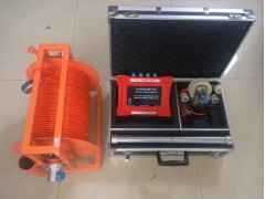
Technical features:
High integration: high integration of system control, image acquisition, and display & storage inside the main instrument;
High expandability: the same hardware system of main instrument is equipped with built-in software and probes with different functions which can provide borehole imaging, borehole peering, and borehole trajectory measurement, thus realizing one instrument for several purposes;
High intelligence: ARM+DSP dual-core processor which can provide picture processing speed of 25
High reliability: the whole system is highly integrated, and has good stability; the instrument is completely sealed, and has good waterproof and dust-proof performance;
High definition: the camera is for colorful, low illumination, 700Lines, 0.01Lux, 13 million pixel pictures; the intensity of light source is continuously adjustable; annular imaging from probe side and end imaging is optional, which guarantees clear imagining for various detection objects;
Wide viewing angle: the camera has wide viewing angle, which can provide 360-degree level panoramic imaging, with no need for focusing;
Good portability: the whole instrument is small, exquisite, light, and easy for carry;
Good operability: the whole set of system is simply connected and easy to operate, even new users can learn how to use it quickly; the main instrument can be used as external USB disk of computers, data can be directly copied and pasted;
Low power requirement: the operating voltage range of the system is between DC5.5V and 12V; high-capacity lithium battery can be built in or 12V storage battery can be externally connected to supply power. The probes can be supplied both by built-in lithium battery and the main instrument. The continuous working hours will be no less than 10 hours;
Flexible switchover among three kinds of display: analysis software can display and output plane expansion graph and stereoscopic bar chart which can continuously rotate for 360 degrees; besides, the analysis software can display rock core de
Direct rock core de
Images can be converted into multiple formats: images can be converted into multiple formatted files like JPG, BMP, and PDF files;
The probes adopt stainless steel shell and tempered optical glass cover, and can bear maximum pressure of more than 20Mpa; the optimal rate of imaging, recording, and synchronous and real-time detection of trajectory is